





All Resources
Introducing BirdsEyeView's New Hail Model

Introducing BirdsEyeView's New Hail Model

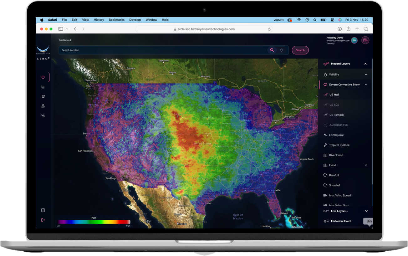
BirdsEyeView has launched a new proprietary severe hail model covering the contiguous US, resolved to 4km — roughly 39x finer than existing vendor hail models. Built on StormWise, BirdsEyeView's in-house storm-tracking algorithm, the model reconstructs full historic hail swaths rather than relying on sparse, urban-biased storm reports, delivering annual occurrence rate and return period data at the industry's standard ≥1" severe hail threshold. It's live now in CERA®.

39x times finer than existing vendor hail models.
10,000x increases real event coverage by roughly
14years of tracking across severe weather days
SEVERE HAIL · CONTIGUOUS US
BIRDSEYEVIEW
DEVELOPED IN PARTNERSHIP WITH ESA

Modelling severe hail across the US

A new proprietary hail model for the contiguous US, resolved to 4km — roughly 39× the spatial resolution of existing vendor hail models.

NEW MODEL · AUGUST 2026
COVERAGE
Full contiguous US (CONUS)
RESOLUTION
4km — roughly 39× vendor models
TEMPORAL EXTENT
2010–2023, updated bi-annually
OUTPUT
Annual occurrence rate and return period
EVENT SAMPLE
~10,000× more event coverage
01 / WHY HAIL IS HARD TO MODEL

Hail-producing storms are brief, often under an hour, and their damage footprints are small — some areas hit heavily, neighbouring regions untouched. Modelling has leant on two resources: multi-decadal NOAA SPC report records, and coarse atmospheric fields that proxy for storms without resolving them. Three problems follow.

01 Dependency on reports

Reports are relied on to capture true event frequency, but recording is biased towards populated areas. Events elsewhere go unreported, so the historic record is skewed and national patterns are lost.

02 Size quantisation bias

Loss is driven by hail size, but reporters round size to reference objects — a nickel, a golf ball. That quantisation strips out the size distributions probabilistic modelling depends on.

03 Fields too coarse

Models fall back on coarse reanalysis signals that cannot resolve storms within a grid cell, so local ingredients are generalised and asset-ready detail is lost.

02 / THE BIRDSEYEVIEW HAIL MODEL
≥ 1″
FIXED THRESHOLD · 25MM

We report the chance of a severe hail event — hailstones of 1 inch (25mm) or larger. That is NOAA's National Severe Storms Laboratory threshold for severe hail, and the point at which damage to property and vehicles typically begins. Smaller stones rarely cause a loss. The threshold is fixed in both Lite and In-Depth mode; what varies by location is how often that size is reached.

Inputs combine national weather network data, historic records, reanalysis and topography at 90m to 4km.

MODEL & METHODOLOGY
BIRDSEYEVIEW
DEVELOPED IN PARTNERSHIP WITH ESA
03 / HOW THE MODEL IS BUILT
01 Track individual storms

StormWise, our in-house severe convective storm tracking algorithm, tracks storms across 14 years of NOAA SPC "severe weather" days — around 100 days of every year.

03 Identify unique events

Observations made on the same day and location are declustered to a single event, and storm-observation matching separates several storms from many reports of one — reflecting how insurers define a single severe hail event.

05 Run the Bayesian model

A Bayesian logistic model runs over more than 10,000 Monte Carlo Markov Chain simulations, capturing model uncertainty and yielding the statistics that inform model confidence.

02 Reconstruct the hail swath

Full historic footprints are reconstructed for every storm qualifying under the StormWise criterion, increasing the sample of real event coverage by roughly 10,000× versus recorded observations.

04 Correct the urban bias

Each model run incorporates the population density of its gridcell, systematically detecting and removing the over-weighted contribution of cities and urban centres to declustered event counts.

Derived atmospheric features indicative of thermodynamically favourable conditions for hail, combined with topography such as elevation, enter the model as covariates. They reinforce known relationships rather than acting as standalone drivers.

04 / WHAT YOU GET IN CERA®
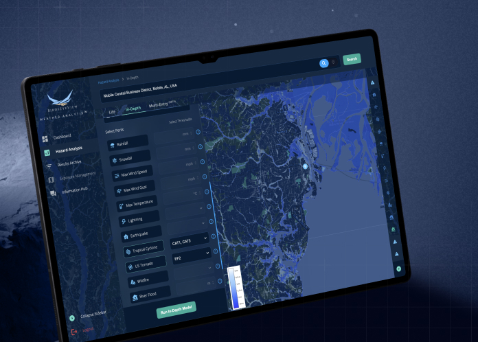
Lite Mode

Annual severe hail occurrence rate (%) and return period. Default threshold ≥ 1″ hail.

In-Depth Mode

Severe hail occurrence rate for an annual period (%) and return period, at the same fixed threshold.

Occurrence rate, not strict probability

Parts of the country genuinely expect more than one severe hail event a year, so a rate can exceed 100% where the history supports it. It is presented as "probability" on the platform for consistency with the other perils; using a rate is what keeps the return-period maths consistent.

Run it against your own book.

The hail model is live in CERA®. If you write US property or hail-exposed risk, we will run it against locations in your portfolio and show you the numbers.

Aisling Lynch
aisling.lynch@birdseyeview.ai
Rory Buckingham
rory.buckingham@birdseyeview.ai

Sources — Severe hail definition: NOAA National Severe Storms Laboratory (hailstones 1″ / 25mm in diameter or greater). Event days: NOAA Storm Prediction Center "severe weather" days, ~100 days per year. Model: BirdsEyeView StormWise storm tracking with event-detection verification, hail swath reconstruction, and a Bayesian logistic Monte Carlo Markov Chain occurrence-rate model. Training window 2010–2023, 4km resolution, updated bi-annually.

Share: