


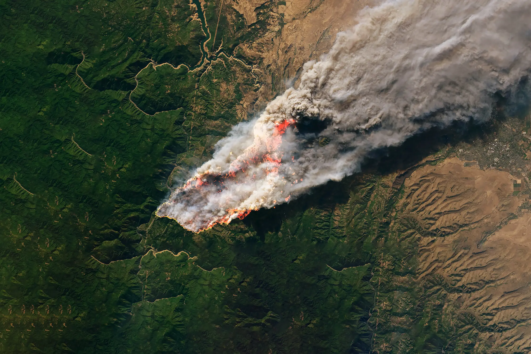
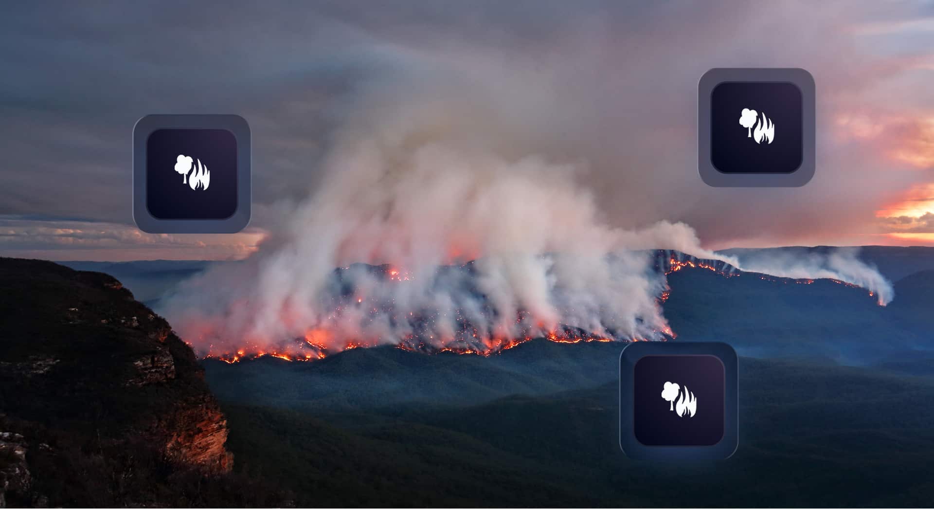
The Data Behind the Fire: A Look Into Our Wildfire Model
Wildfires now result in nearly 6 million more hectares of tree cover loss per year than in 2001, an area the size of Croatia.
Feb 19, 2026

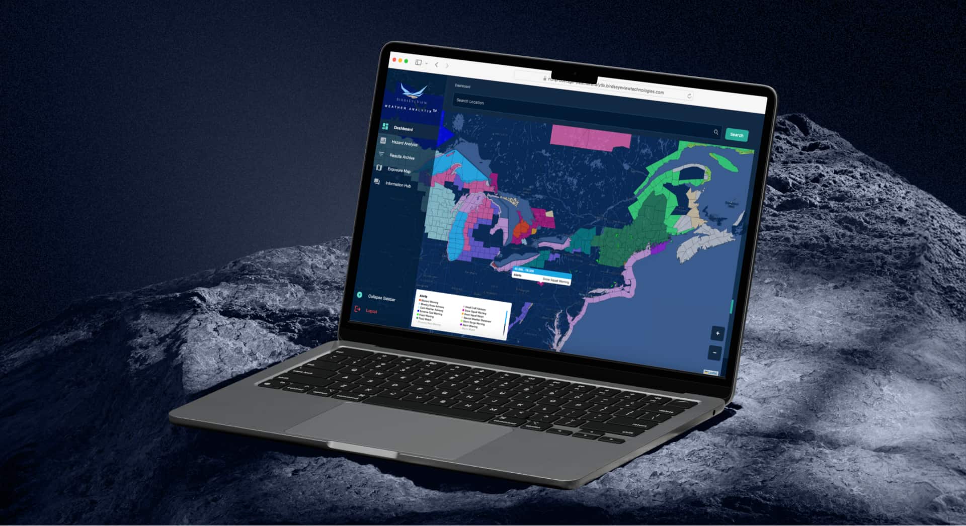
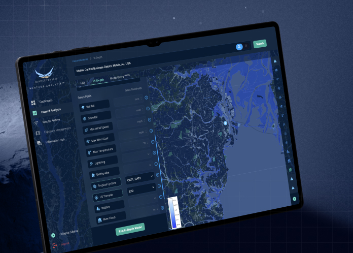
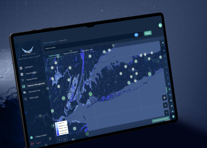
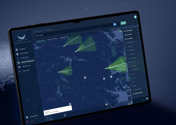
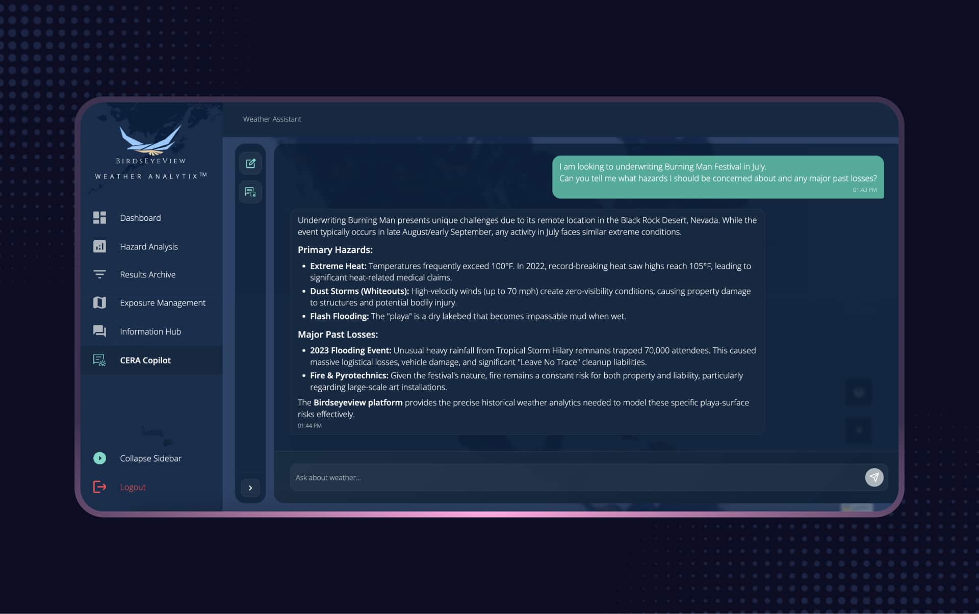
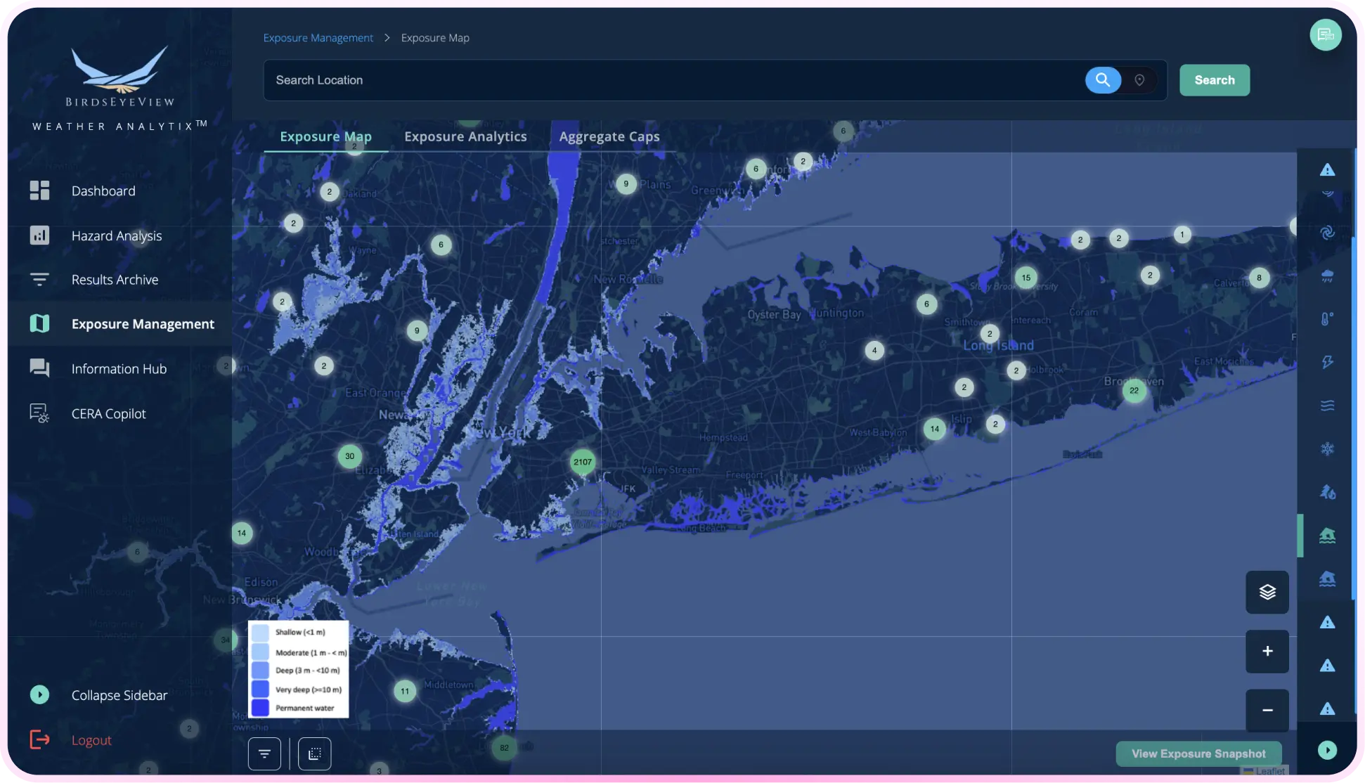
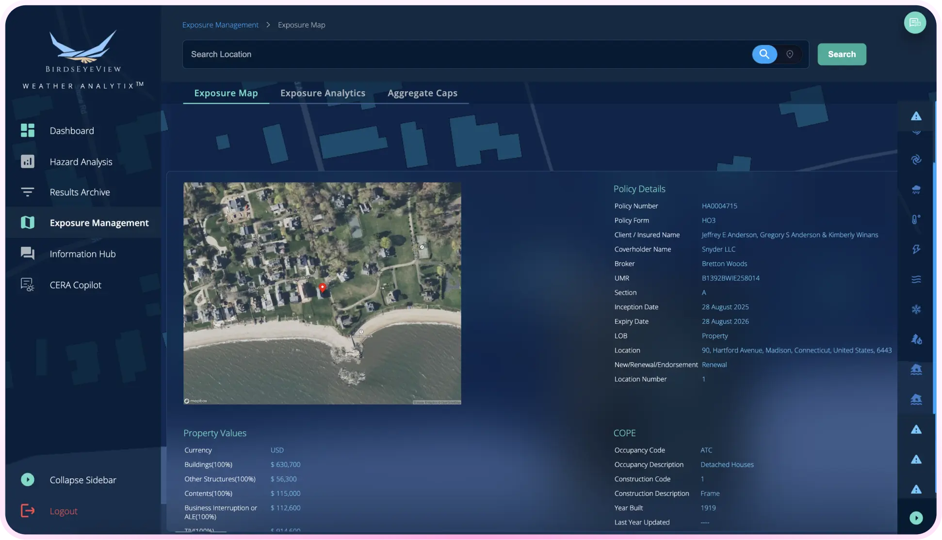
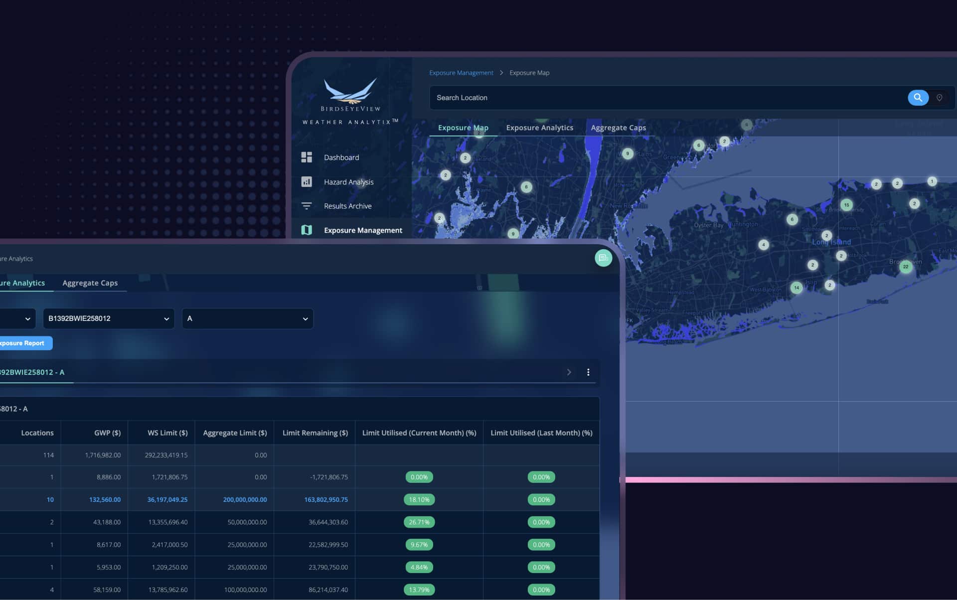
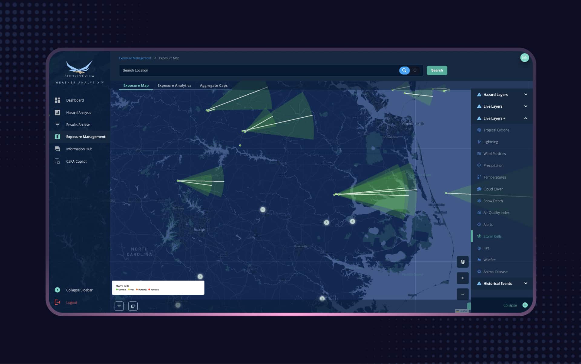
From brokers, to underwriters, to actuaries, CERA® enables real-time location risk analysis and portfolio management at your desk.


BirdsEyeView Secures Seven-Figure Investment to Accelerate Global Expansion
BirdsEyeView, the European Space Agency-backed insurtech specializing in natural catastrophe modelling and exposure management, has secured an undisclosed seven-figure investment to support the company’s continued international growth and ongoing product development.
Have questions about CERA®, integrations, pricing, or use cases for your organization? Our specialists can walk you through the platform and recommend the right solution.